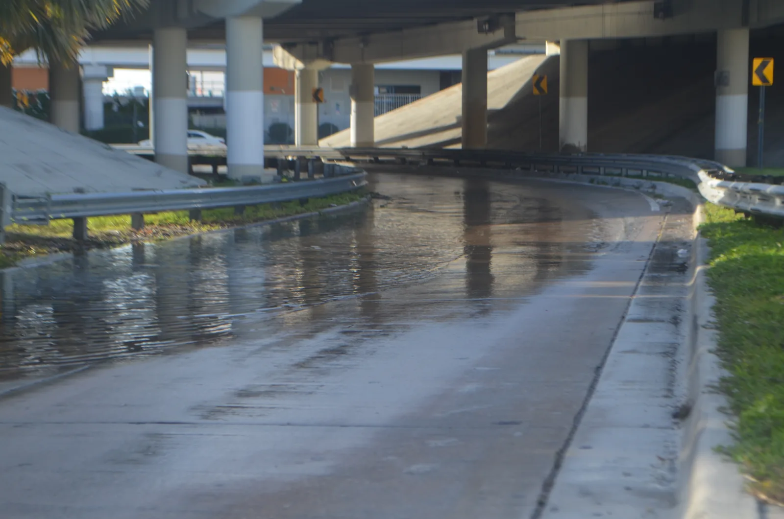
Moderate tidal flooding is possible at high tide through 8 p.m. Saturday, the weather service says. The Virginia Key gauge hit 1.72 feet Wednesday evening.
Salt water could cover low streets, parks and yards in coastal Miami-Dade at each high tide through Saturday. The National Weather Service in Miami has a coastal flood advisory in effect until 8 p.m. Saturday. It covers coastal Miami-Dade County, which includes Coral Gables, and coastal Broward County.
The weather service expects “moderate coastal flooding.” It warns of “flooding of lots, parks, and roads with only isolated road closures expected.” That is a step up from the minor flooding it forecast earlier in the week.
How the alert grew this week
The weather service raised the alert level twice in 24 hours, according to its coastal hazard messages:
- Tuesday, 9:52 p.m.: a coastal flood statement for “isolated minor coastal flooding,” the lowest level, from 3 a.m. Wednesday through Thursday evening.
- Wednesday, 2:41 p.m.: upgraded to a coastal flood advisory for moderate flooding, until 11 p.m. Thursday.
- Wednesday, 11:58 p.m.: the advisory was extended to 8 p.m. Saturday.
A high rip current risk runs for the same beaches through Saturday evening.
What the tide gauge recorded
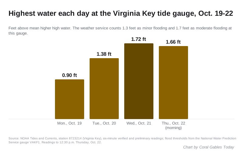
The closest NOAA tide gauge is at Virginia Key, about seven miles northeast of Coral Gables. Its readings show the water climbing each day this week. The figures are in feet above mean higher high water, the average height of each day’s highest tide.
| Day | Highest reading | Time |
|---|---|---|
| Monday, Oct. 19 | 0.90 feet | 4:54 p.m. |
| Tuesday, Oct. 20 | 1.38 feet | 5:36 p.m. |
| Wednesday, Oct. 21 | 1.72 feet | 6:18 p.m. |
| Thursday, Oct. 22 | 1.66 feet | 6:36 a.m. |
The weather service’s National Water Prediction Service counts 1.3 feet at this gauge as minor flooding and 1.7 feet as moderate flooding. Wednesday evening’s tide crossed the moderate line.
The water is running well above the tide tables. NOAA predicted Wednesday evening’s high tide at 0.22 feet. The gauge measured 1.72 feet, about 1.5 feet higher. Thursday morning’s tide came in about 1.4 feet above its 0.26-foot prediction.
When the next high tides are
The predicted high tides at Virginia Key through the end of the advisory, from NOAA’s tide predictions:
| Day | Morning | Evening |
|---|---|---|
| Thursday, Oct. 22 | 6:36 a.m. | 6:55 p.m. |
| Friday, Oct. 23 | 7:24 a.m. | 7:37 p.m. |
| Saturday, Oct. 24 | 8:11 a.m. | 8:20 p.m. |
The predicted tide rises a little each day through Saturday. The flooding is worst in the hours around each high tide.
The weather service forecast for Coral Gables calls for northeast winds of 10 to 20 mph Saturday, with gusts up to 28 mph. It gives a 50% chance of showers and thunderstorms Friday and 60% Saturday. Rain at high tide has nowhere to drain, which makes street flooding worse.
King tide season
This week opens another of the year’s king tide windows. The city’s king tides page lists Oct. 22 to Nov. 12 as one of its 2026 periods, with two more in late November and late December. The city said the effects are felt mostly along the coast and in very low areas near the water, and that streets can flood with no rain at all.
We covered the first window earlier this month, when the weather service issued only a statement.
What it means for you
The weather service and the city advise:
- Do not drive around barricades or through water of unknown depth. Allow extra time if you have to travel near the water.
- Move cars out of low spots before high tide. If you drive through salt water, rinse the car with fresh water afterward.
- Avoid walking through floodwater. If you have to, wash your hands, clothes and pets afterward.
- Boaters: check the tide before leaving the dock. High water cuts clearance under bridges.
- At the beach, swim near a lifeguard. If a rip current catches you, float and swim parallel to the shore.
- Send photos of tidal flooding on your street to sustainability@coralgables.com. The city uses them to document where water collects.
Our hurricane prep guide covers flood zones and sandbags. For a non-emergency question, call the city at 305-446-6800.
Have your say