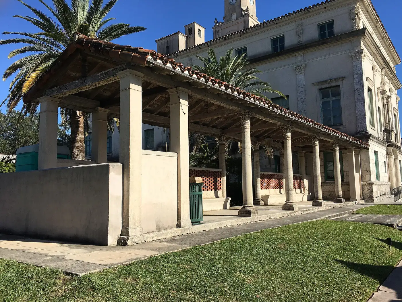
11 Coral Gables neighborhoods from the Flagler Section to Gables by the Sea: ZIP codes, zoned schools and 2026 grades, and August 2026 Zillow values.
Last checked Oct. 8, 2026. Sources: the City of Coral Gables’ section and subdivision plat layer, master plan boundaries, Central Business District layer and homeowner association layer; Miami-Dade County’s address points and school attendance boundaries; the Florida Department of Education’s 2026 school grades; Zillow Research; the Census Bureau; and OpenStreetMap.
Coral Gables is a city of 49,802 people in Miami-Dade County, according to the Census Bureau’s 2020-2024 American Community Survey. It is long and narrow: from Tamiami Trail (Southwest Eighth Street) and the Flagler Section in the north, it runs south past downtown, the University of Miami and US 1 to the neighborhoods along Old Cutler Road, about 8 miles by road from City Hall to Gables by the Sea. Douglas Road (Southwest 37th Avenue) is much of its eastern line with Miami, and Red Road (Southwest 57th Avenue) much of its western edge.
The city was laid out in named sections, and its plat map still records them: the Granada Section, the Country Club Section, the Riviera Section and others. Downtown is the Central Business District around Miracle Mile, and Ponce de Leon Boulevard runs north to south through the middle, with the free city trolley on it.
Three things to know before you look at a listing:
- Five main ZIP codes. Of about 13,700 address points inside the city in Miami-Dade County’s address data, 51% are in 33134; 28% in 33146; 9% in 33156; 7% in 33143; and 4% in 33133. Zillow files 33156 under Pinecrest and 33143 and 33133 under Miami, so a ZIP code alone does not tell you the city.
- Two high school zones. In the county’s attendance boundary maps, about 92% of addresses are zoned for Coral Gables Senior High and 8%, in the far south, for Miami Palmetto Senior High in Pinecrest.
- School zones do not follow the city line. Many Coral Gables addresses are zoned for elementary schools in Miami, among them Sunset, David Fairchild and Auburndale. Check every address in the district’s SchoolFinder.
The areas at a glance
The ZIP code is where most of the area’s address points are. The home value is the Zillow Home Value Index for that whole ZIP code in August 2026: a modeled typical value for the middle third of homes, single-family homes and condos together, not a sale price. The citywide figure was $1,558,867.
| Area | Main ZIP | Zoned high school | Typical value in the ZIP, Aug. 2026 |
|---|---|---|---|
| Flagler Section | 33134 | Coral Gables Senior (97%) | $883,278 |
| North Ponce | 33134 | Coral Gables Senior | $883,278 |
| Granada Section | 33134 | Coral Gables Senior | $883,278 |
| Downtown | 33134 | Coral Gables Senior | $883,278 |
| Coconut Grove Section | 33134 | Coral Gables Senior | $883,278 |
| Country Club Section | 33134 and 33146 | Coral Gables Senior | $883,278 and $1,933,213 |
| Riviera Section | 33146 | Coral Gables Senior | $1,933,213 |
| Sunrise Harbour | 33133 | Coral Gables Senior | $1,365,684 |
| Cocoplum | 33143 | Coral Gables Senior | $954,408 |
| Gables Estates | 33156 | Coral Gables Senior | $1,521,088 |
| Gables by the Sea | 33156 | Miami Palmetto Senior | $1,521,088 |
Coral Gables Senior High earned a B and Miami Palmetto Senior High an A in Florida’s 2026 school grades.
Map
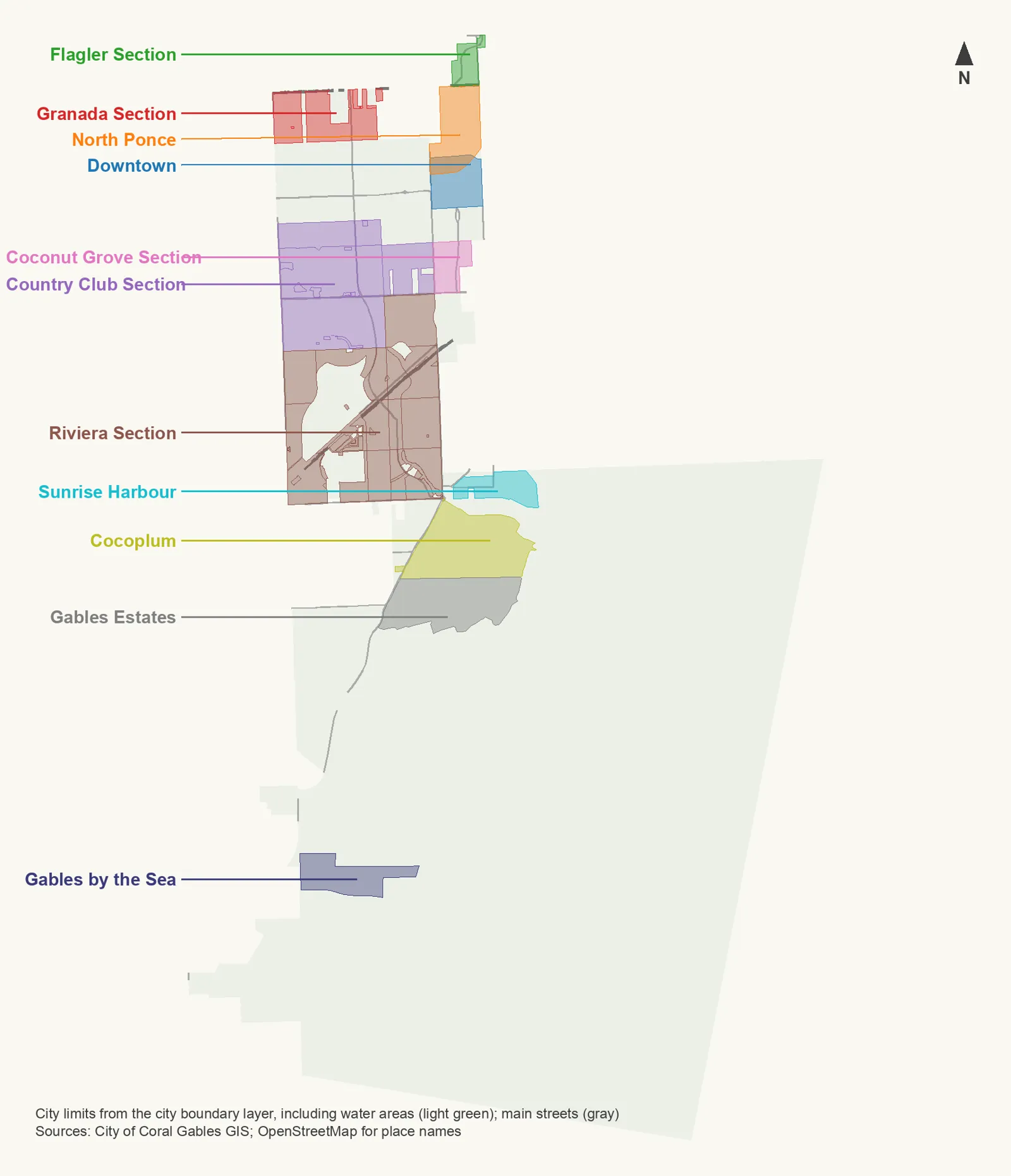
Map by Coral Gables Today. Area outlines, city limits and streets are from the City of Coral Gables’ map layers; place names are checked against © OpenStreetMap contributors.
The areas
Flagler Section. The corner of the city north of Tamiami Trail, about 70 acres between Ponce de Leon Boulevard and Douglas Road, and the only part of Coral Gables zoned for Auburndale Elementary and Kinloch Park Middle.
North Ponce. About 222 acres between Douglas Road and LeJeune Road from Tamiami Trail south to downtown, with Phillips Park, a Publix and a Target inside it.
Granada Section. About 264 acres in the northwest corner, off Tamiami Trail and Red Road, with the Granada Entrance on Granada Boulevard.
Downtown. The 164-acre Central Business District around Miracle Mile and Ponce de Leon Boulevard, with City Hall on its western edge. See also our Miracle Mile and downtown guide.
Coconut Grove Section. About 102 acres on Ponce de Leon Boulevard north of Bird Road, in Coral Gables despite its name, about 0.8 mile by road from Douglas Road Metrorail station.
Country Club Section. Six plats wrapped around the Biltmore Golf Course, from De Soto Boulevard and the Venetian Pool south to Blue Road, split among three elementary zones.
Riviera Section. About 1,260 acres on both sides of US 1 beside the University of Miami, with University Metrorail station at its edge.
Sunrise Harbour. About 128 acres around Edgewater Drive in the southeast, in ZIP 33133 and zoned for Coconut Grove Elementary.
Cocoplum. About 437 acres east of Old Cutler Road, south of Cartagena Plaza, zoned for Sunset Elementary.
Gables Estates. About 378 acres east of Old Cutler Road, north of Matheson Hammock Park, with about 160 address points.
Gables by the Sea. About 190 acres in the far south, zoned for Pinecrest Elementary, Palmetto Middle and Miami Palmetto Senior High.
To compare the city with its neighbors on taxes, schools and home values, see Coral Gables vs. South Miami vs. Pinecrest vs. Palmetto Bay.
How we built this
We named only areas a public source places on a map. The sources were:
- The City of Coral Gables’ section and subdivision plat layer, which records the named sections the city was laid out in. We used the Granada, Country Club, Riviera, Coconut Grove and Flagler Street sections, joining the parts and revisions of each.
- The city’s master plan boundaries layer, which outlines North Ponce and the Flagler Section, and its Central Business District layer for downtown.
- The city’s homeowner association layer, which draws 19 association areas. We used four as neighborhood outlines (Sunrise Harbour, Cocoplum, Gables Estates and Gables by the Sea) and checked them against OpenStreetMap place names, which include Gables by the Sea, Sunrise Harbor and Gables Estates. Smaller association areas, such as Snapper Creek Lakes and Journey’s End, and the city’s small historic “villages” are not covered.
- Miami-Dade County’s address points, about 13,700 inside the city, used for ZIP code shares and matched on Oct. 8 to the county’s school attendance boundary layers. The district’s SchoolFinder is the final word for any address.
- Distances measured on the OpenStreetMap road network with the OSRM routing engine; bus routes from Miami-Dade County’s bus route layer; parks from the city’s parks layer; stores from OpenStreetMap, © OpenStreetMap contributors.
We do not rank areas. Every figure on these pages is from a named public source; if you see one that is out of date, tell us on our corrections page.
Related: schools, home prices, property taxes, getting around, parks and trails and moving here.
Frequently asked questions
What are the neighborhoods in Coral Gables, Florida?
The city was laid out in named sections, such as the Granada, Country Club and Riviera sections, and its maps also outline downtown, North Ponce, the Flagler Section and homeowner association areas such as Cocoplum and Gables Estates. Our guide covers 11 areas from the Flagler Section in the north to Gables by the Sea in the south.
What ZIP codes are in Coral Gables?
Mainly five. Of about 13,700 address points in the city in Miami-Dade County’s address data, 51% are in 33134, 28% in 33146, 9% in 33156, 7% in 33143 and 4% in 33133, with a few in 33158, 33155, 33144 and 33135.
What high school is Coral Gables zoned for?
Most of it. In Miami-Dade County’s attendance boundary maps, about 92% of the city’s address points are zoned for Coral Gables Senior High and 8%, in the far south, for Miami Palmetto Senior High.
Which Metrorail stations serve Coral Gables?
Douglas Road and University stations, on US 1, are the closest for most of the city; South Miami station is near its southwest edge. The free Coral Gables Trolley runs from Douglas Road station along Ponce de Leon Boulevard.
Do Coral Gables school zones follow the city limits?
No. Miami-Dade County Public Schools draws its own zones, and many Coral Gables addresses are zoned for schools in Miami or Pinecrest, such as Sunset Elementary, David Fairchild Elementary or Miami Palmetto Senior High. Check any address in the district’s SchoolFinder.
Have your say